For a video version of this blog, click here to take you to the YouTube video.
Red Rock Canyon National Conservation Area is about 20 minutes outside of Las Vegas in the Mojave Desert and is on BLM (Bureau of Land Management) Land. If you have an America the Beautiful National Parks pass, you can get in free!
Red Rock includes one big 13 mile scenic loop, and the road is wide so it’s easy for any RV. We were just passing through on our way from Las Vegas to Death Valley National Park, and had our 17’ Minnie Winnie trailer with us. If you’re really short on time, or have a really large RV, you can always just drive the loop. Dogs ARE allowed on the trails, but we didn’t have our pup with us on this trip.

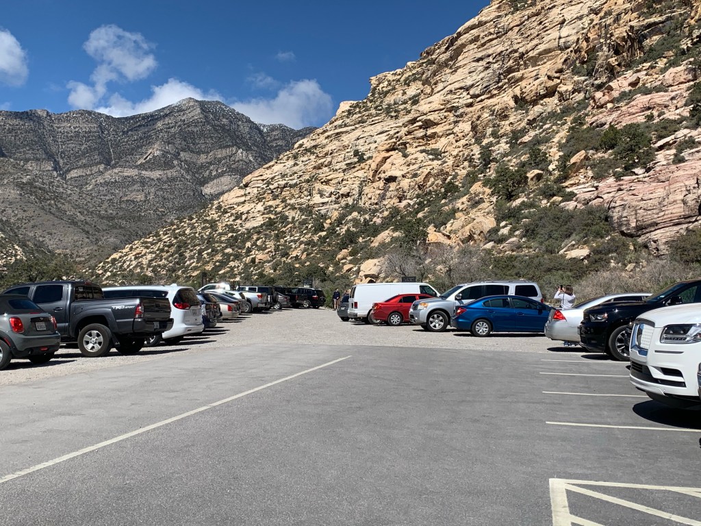
The Visitors center has an upper and lower parking lot, and the lower lot can accommodate quite a few RV’s, even large ones.


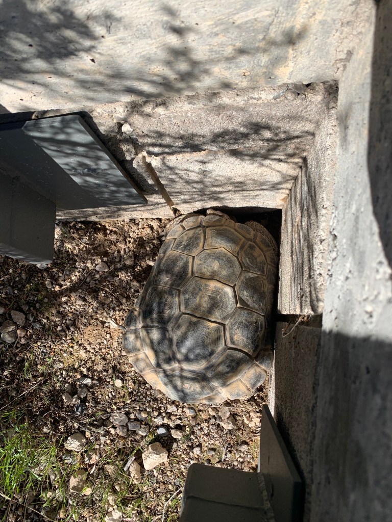
At the visitor’s center you can visit the tortoise habitat outside. From November to March they are typically in a type of hibernation called brumation, but we were fortunate enough to see one of the desert tortoises out of his burrow.
As you travel along the loop, you may or may not have trouble finding a place to park with an RV. Because it was off season (mid March) and our trailer is relatively small, we didn’t have too much trouble finding a place to park at the places we wanted to stop, but it probably wouldn’t be that easy during peak times.
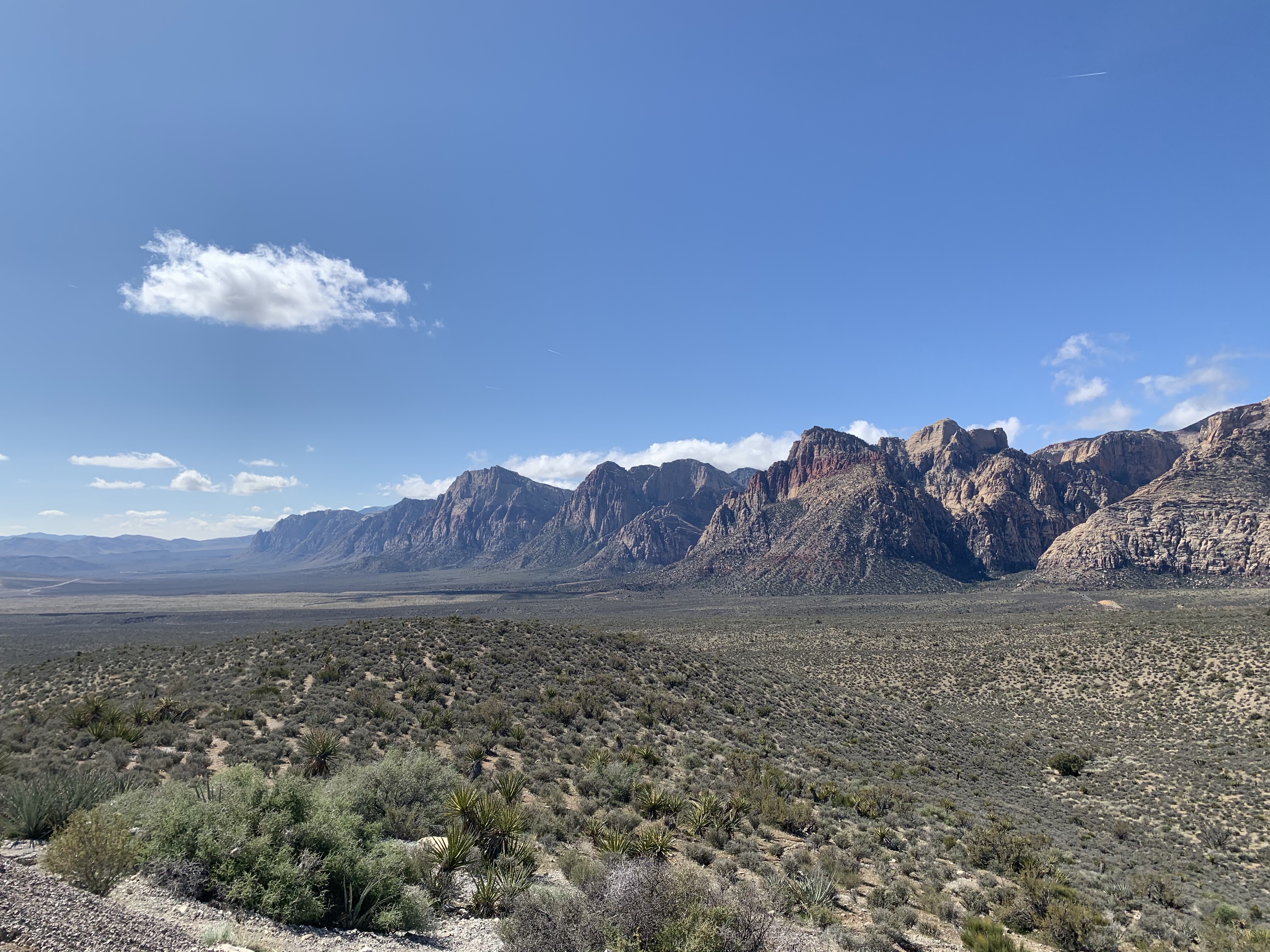
We planned our stops so we could see the most in our less than ½ day visit. Our first stop was High Point Overlook which gives you a grand view looking back towards the visitor’s center (pics don’t do it justice, but of course I’m posting them anyway). There was parking for 2 RVs or buses in this small lot and we were able to snag one of the spots. NOTE: If the space is marked for “Buses”, don’t park your RV there. They will make you move.


The Willow Spring Picnic Area has 3 areas to explore and is a “must see”! There’s a main parking lot, then if you go a little further, a gravel road and another lot.
In the Willow Spring Picnic Area, the road is 2 way so if you miss a stop you can just pull into one of the parking lots and when you pull out, you can easily go in the other direction

We were able to snag a spot in a gravel parking area on the side of the road that was just perfect, though it did take a little finagling for my husband to park.

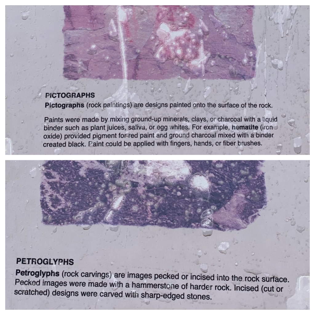
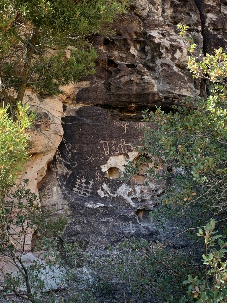
Here we first walked the Petroglyph Wall Trail, a short .15 walk to view the petroglyphs. Do you know the difference between a petroglyph and a pictograph? We didn’t!

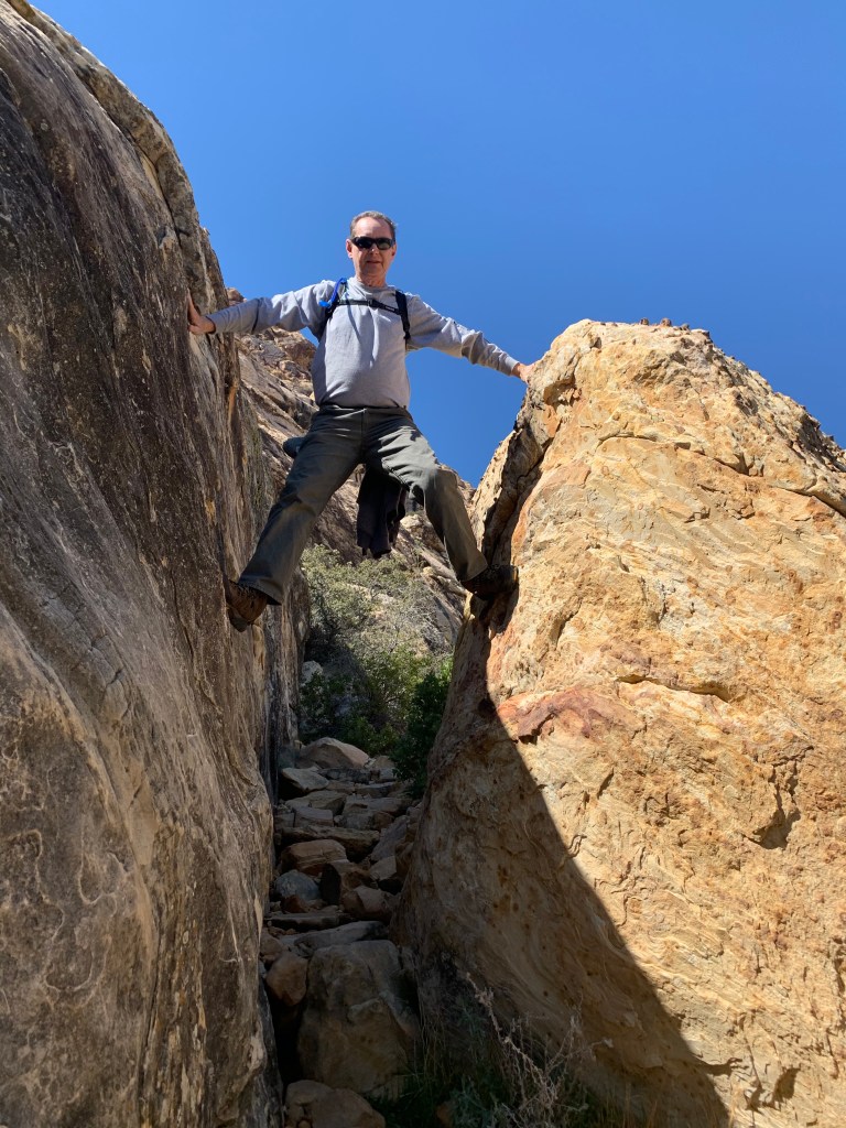
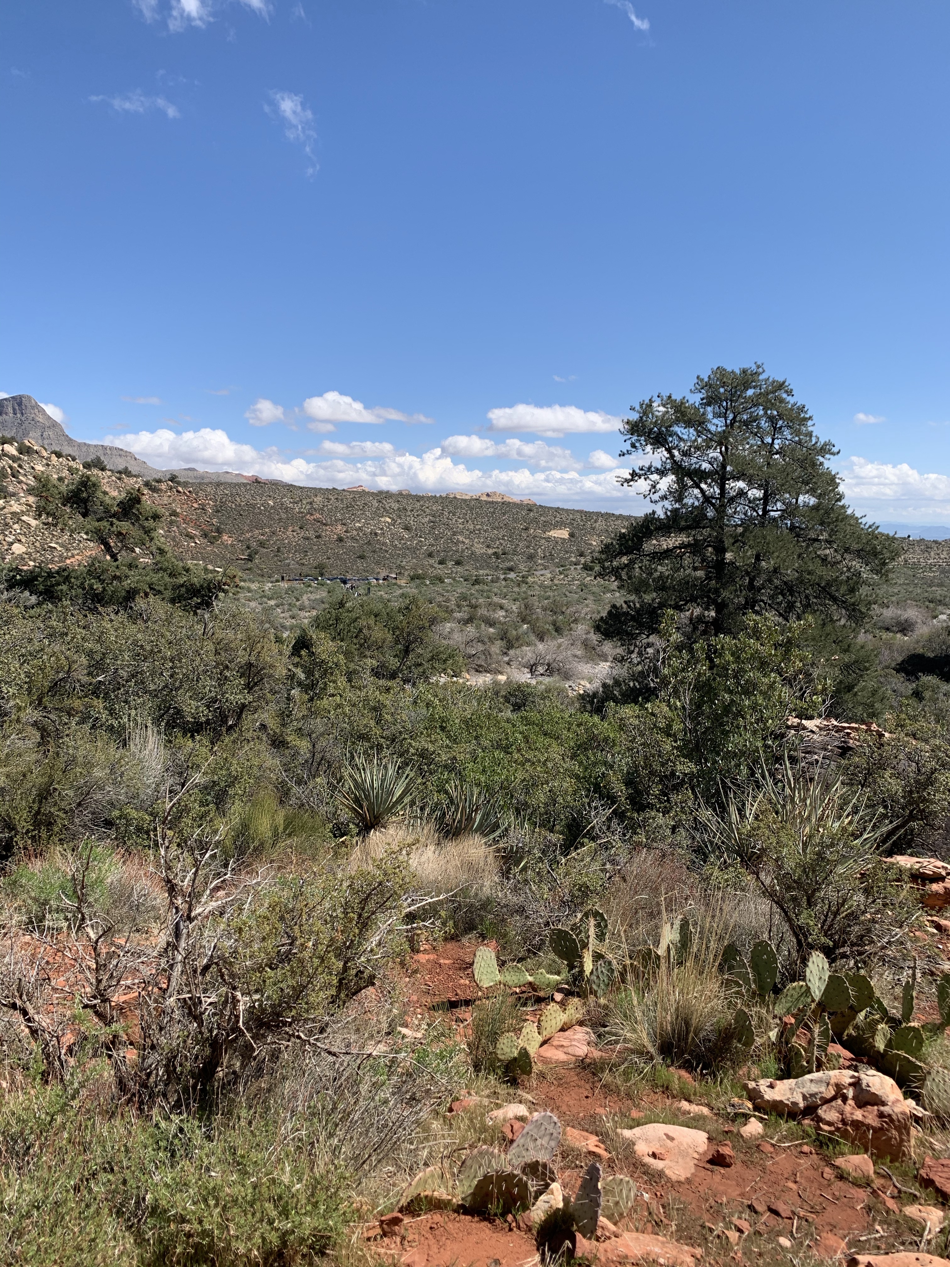
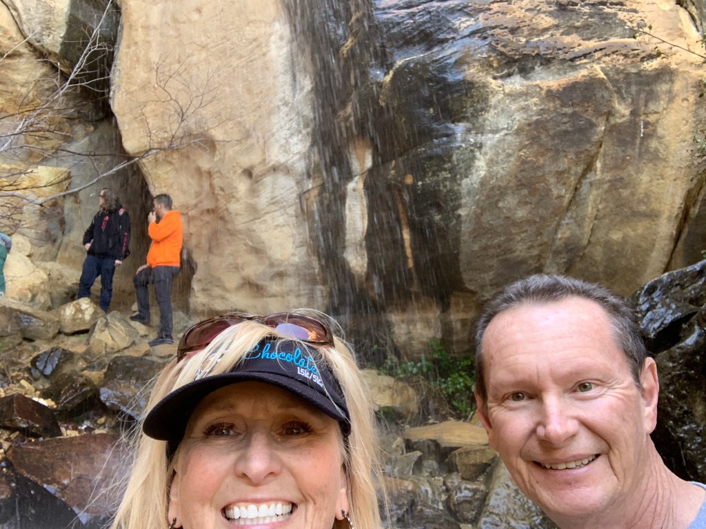
Our favorite trail at this stop was the Lost Creek Children’s Discovery Trail. It’s less than a mile but has a lot to see. It’s a combination of rocky, often uneven terrain and a short boardwalk trail. In areas where the path is uneven they have build in rock “steps” to make it easier to traverse. As long as you’re steady on your feet, it’s a very easy trail. I loved seeing all the different kinds of vegetation (including Joshua Trees), some wildflowers, a stream, beautiful sandstone rock formations and, depending on the recent rainfall or snowpack, you may even get to see a waterfall!


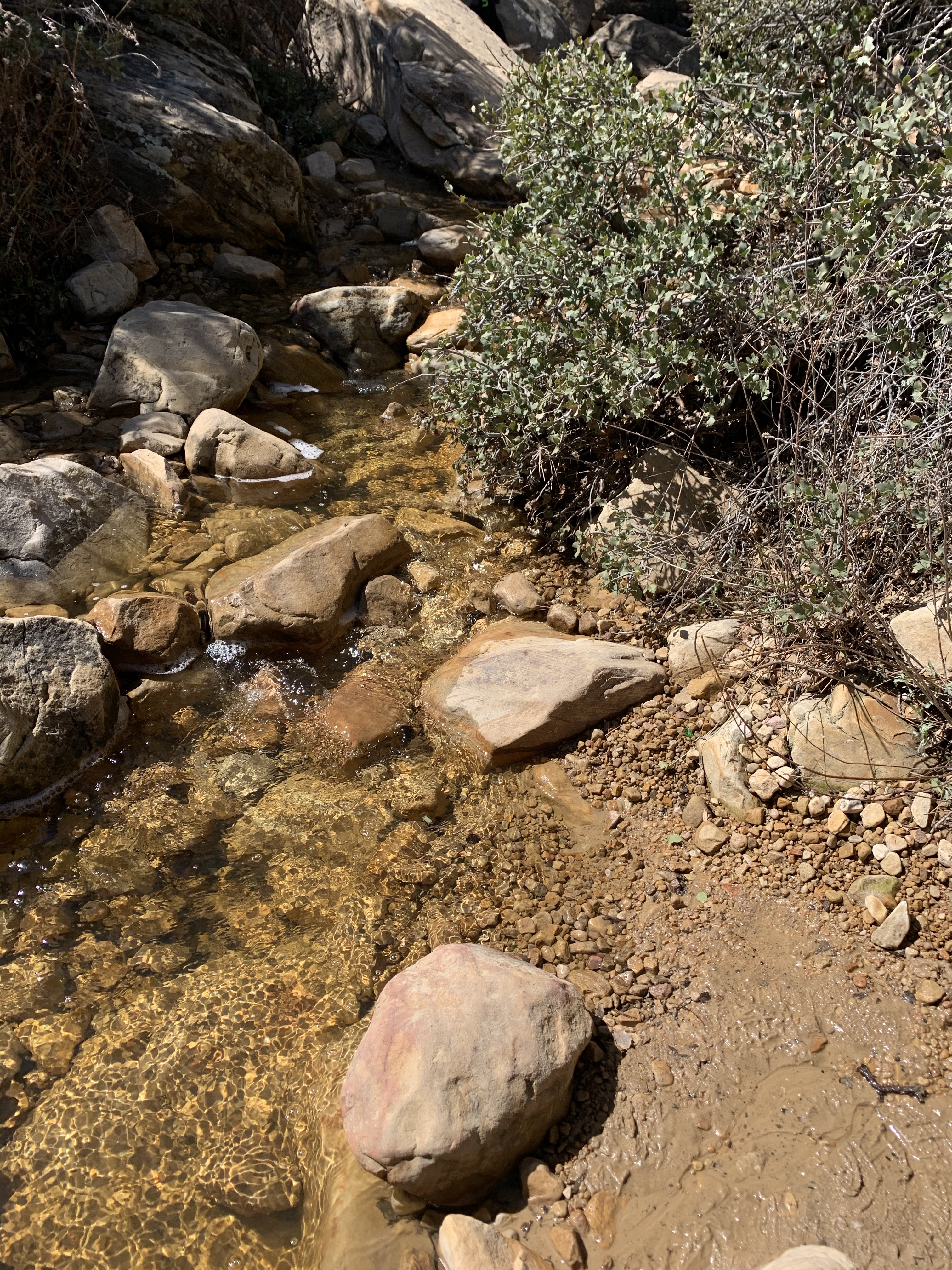


This was by far my favorite stop. I’m a water person and it was so relaxing and refreshing to the spirit! The temps were mild when we visited in March (high 50’s and 60’s and sometimes windy), but it’s VERY hot in the summer months, so be prepared and bring lots of water!

Here’s a link(Click here) to the .pdf map and general info
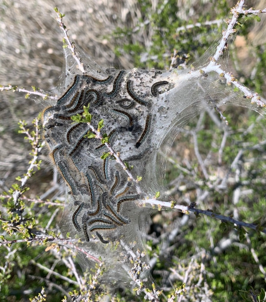
There were lots of these silk-like cocoons in the bushes. I did a little research and found out they are Western Tent Caterpillars, and they spin this web around themselves from their mouths. I had a video of this but lost it (waaaaaa!). They were really fascinating!
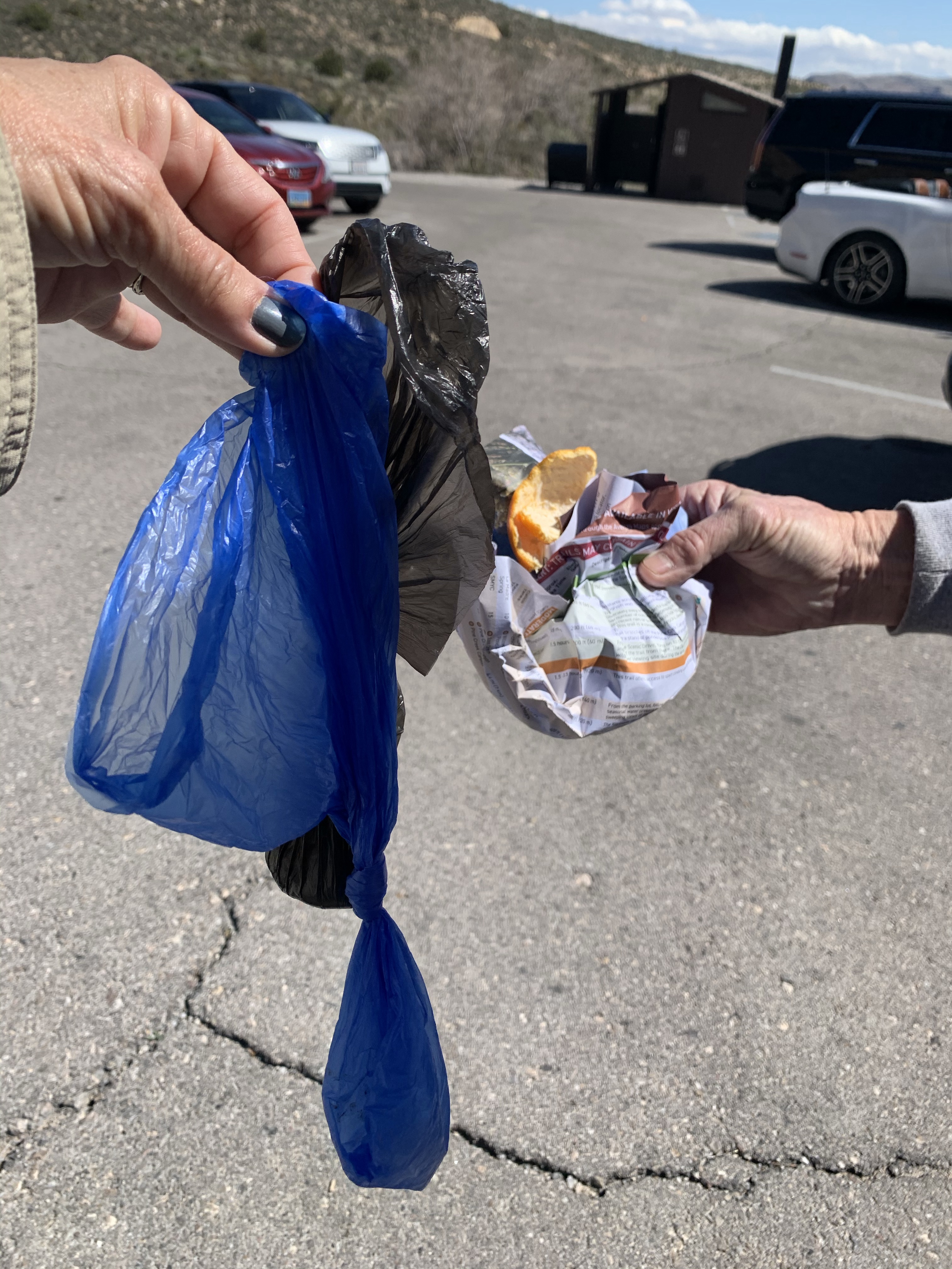
On the way back to our car we tried to do our part and pick up some trash. It’s so sad how people can be so disrespectful. I mean, they pick up their dog’s poop, then leave it there instead of carrying it out?!!! (SMH)

There’s a lot more to see but after this we decided to hit the road and grab a quick lunch so we could get to Death Valley before dark.
On the drive out we came to an area that was still partially flooded from the rain more than 24 hours earlier. I’d imagine it floods out in a major storm.


Have you been to the Red Rock Conservation Area? What was your favorite, and what did we miss? Tell us in the comments below.

*NOTE: We visited Red Rock just as the Covid-19 outbreak was starting, but we were not “shut down” and the mask mandate was not yet in effect. It was suggested that we keep a good 6’ distance from others (which we did), but obviously these areas had not yet closed. They closed within the next week after our visit.
